
S.P. Scott, in his 1904 tome, The History of the Moorish Empire in Europe, wrote:
"The noble and elevating pursuits of science were not neglected under the Moors of Sicily and their intelligent and progressive conquerors, the Norman princes. Geography, astronomy, chemistry, and medicine were studied with diligence and success. al-Idrisi, whose decent from the royal dynasty of the Fez has been obscured by the eminent reputation he attained as a geographer and a philosopher, made for Roger II a planisphere which represented at once the surface of the earth and the positions of the heavenly bodies. From the minarets of Palermo, the Arab astronomer observed the motions of the planets, the periodical recurrence of eclipses, the relative positions and general distribution of the stars in space, by the aid of instruments invented on the Guadalquivir and the Tigris, and of tables computed on the plains of Babylon centuries before the Christian era. The Moslem thus consecrated to the prosecution of scientific research the towers of his most sacred temples, at a time when from the cathedrals of Europe doctrines were promulgated which menaced, with the severest penalties that ecclesiatical malignity could devise, every occupation which in any way contributed to the emancipation of reason or the intellectual progress of humanity [...]"
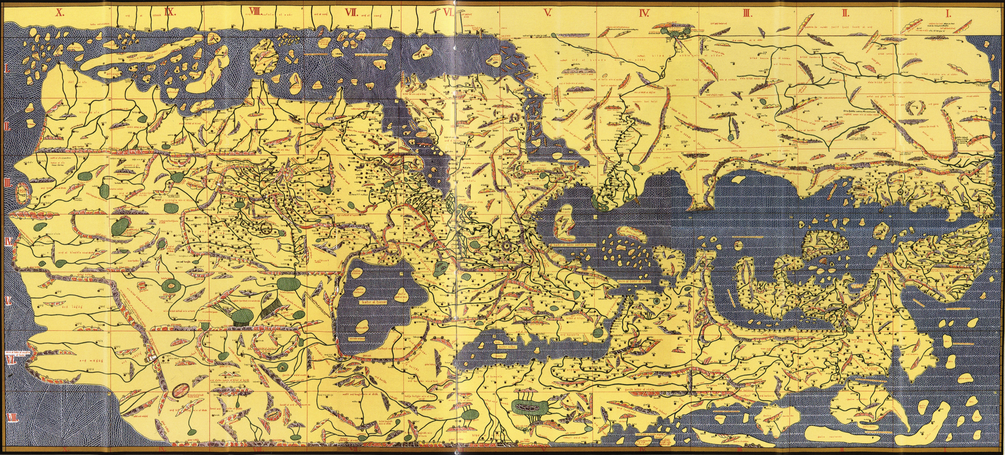
"The great work of al-Idrisi was compiled under the auspices of Roger II. The Arab was peculiarly fitted for the treatment of the comprehensive science of physical and descriptive geography. His information had been largely obtained by practical experience. He had served in campaigns conducted on the frontiers of civilization; in the capacity of a merchant he had traversed with the plodding caravan vast regions diversified with illimitable plains, lofty mountains, noble rivers; as a pilgrim he had performed his devotions at the cradle of the Moslem faith; in the tirels pursuit of learning he had prosecuted his researches over strange countries and among strange peoples; his features and his costume were familiar to the residents of the great European and Asiatic capitals; his peregrinations had extended from the Douro to the Indus, from the shores of the Baltic to the sources of the Nile. Thus endowed with especial qualifications, the Arab geographer was equally at home, whether recounting to a delighted audience the experiences of an extended journey or explaining to an assemblage of students the physical features of the earth and the relative distribution of land and water as depicted on the surface of a terrestrial globe. The work of al-Idrisi is an imperishable monument to the intelligence, the industry, the criticism, of the compiler, whose studies were confirmed in many instances by personal observation, and hte practical value of whose undertaking was established by his scientific atainments as well as by the copious erudition of the illustrious monarch by whose command it originated and was brought to a successful termination." (Pp. 68 - 72)
To read more from this book click here.
To see an online exhibition from the Bibliothèque nationale de France dedicated to Muhammad al-Idrisi (in French) click here.


No comments:
Post a Comment